The JMS client
PGA Tour – Mapping, CAD and GIS Services
EA Sports – Mapping and CAD Services
Golf Course Architects – Mapping, CAD and Analytic Services
Golf Course Superintendents – Mapping, CAD, GIS and Data Acquisition
Golf Course Irrigation Consultants – Mapping, CAD, GIS and Data Acquisition
Established in 1997, JMS Geomatics is focused on mapping, CAD, GIS and data acquisition for the golf industry. We have completed over 400 projects in 39 states and 13 countries.

25
YEARS In business
500+
projects
41
states
14
countries
Stunning
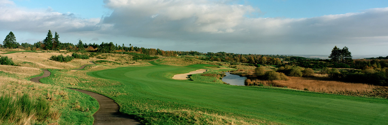
Aerial photography
JMS Geomatics uses UAV/Drone technology to capture imagery that is used to generate orthophotos and terrain models in the United States, Europe and Asia. We also capture video fly throughs of your course.
top-tier Mapping
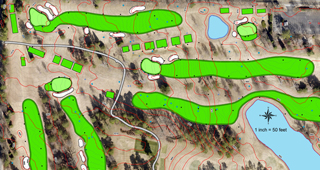
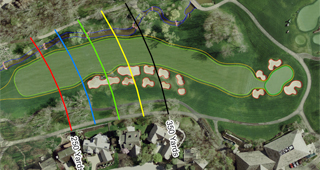
JMS Geomatics uses survey grade GPS, Robotic Total Stations and Scanning Lasers for our ground based mapping. We also use UAVs/Drones and integrate other data sets like Lidar and existing orthophotos into the process.
JMS Geomatics serves golf course architects, superintendents, irrigation consultants, and The entire golf industry.
• Mapping
• Aerial Photography
• UAV/Drone Mapping
• Green Scanning
• GIS Cad
• Topography
• Area Calculations
• Irrigation As-Builts
• Yardage Books
• Photography
read more
navigate
- About Us
press
contact
JMS Geomatics, Inc
Oro Valley, Arizona • USA
520-797-0773